This is a log of my fourth tour to Torres del Paine where Grey Lake is located.
Incoming mail
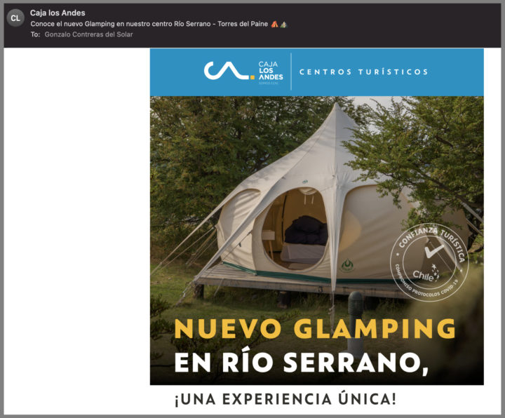
It started when I received an advertising mail from Caja de Los Andes. Could see round tents (Domes) that had almost the same accommodations than a hotel room but on a tent. They were located at Torres del Paine National Park, one of my favorites. I knew that my son would have vacation availability during December, so looked for options that worked for both.
Mid December was the date. Immediately checked for the Domes availability and if the direct flights to Puerto Natales town had already started.
Puerto Natales is about 1.5-2 hours’ drive from the park and very convenient, however the airport works only during summertime. The alternative airport is at Punta Arenas, 3 hours away from Puerto Natales, long road with extreme Patagonia wind.
I confirmed both bookings, however when requesting the rental car reservation, Avis nor Herts were not operating at Puerto Natales. This was a major hiccup, as without transportation we could not move freely within the park, distances are very big.
After many Google searches, found a small local rental car company that had availability.
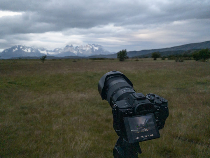
I normally plan for destinations and activities, but in this case with an open calendar, as Patagonia weather is unpredictable. Had only in mind a few key points and activities. The weather predictions said rain for two or three days, so we would need to crunch activities on sunny days.
Flight
On a previous flight that had a stopover, the airplane shock as leaf on a wind tunnel. This time it was nonstop and very convenient, leaving at 10AM arriving at 1PM.
Very little turbulence, partial cloudy which was a good indication for the coming days.
As soon as we landed, while I was signed the rental car agreement, my son collected the baggage. Reading the small letters, I found out that the insurance deductible was very high, nothing to do at this point. Just to drive carefully reducing the speed, as the Patagonia wind is very strong and can flip over your car. I remembered that on previous occasion, found 3 cars wheels looking to the sky.
We were starving, and I knew a restaurant in the center of town, so we rushed driving there.
“Asador Patagónico”, which I came with my wife a couple of years ago, it had excellent lamb.
We were disappointed seeing it closed, I thought it was permanently closed, like many other places that perished with COVID.
I fact, we found all stores and restaurants closed. We had to rush finding a supermarket that could be opened. Fortunately, there was one that had the items we needed, including beer. The 12 years old whisky came along with us, which was to be drank with the glacier ice.
The distance from Puerto Natales to the park is just about 90 kilometers, but Waze indicated 1.5 hours. We later discovered that some sections of the road were full of holes having to reduce dramatically the car speed.
Cuevas del Milodón
A few kilometers north of Puerto Natales we arrived at the Cuevas del Milodón caves. They were created by the surf water of a glacier lake that was adjacent to a mountain with different soil layers.
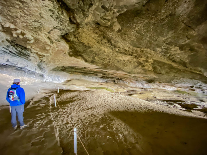
One of the soil layers was lime, was easily washed out by the waves creating the caves. Hermann Eberhard a German Patagonia explorer, in 1895 discovered them. Finding a large, seemingly fresh piece of skin of an unidentified animal. In 1896 Otto Nordenskjöld during his exploration recognized the skin belonged to Mylodon, extinct animal dying 10,200–13,560 years ago.
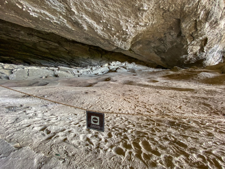
After paying the entrance fee, and about 15 minutes’ walk we arrived at the largest cave, 200 meters long. There is a trail to walk around the cave, sadly many people didn’t respect signs, finding footsteps outside this trail.
On our way back we found a tourist shop and cafeteria, with small stuffed Mylodon puppets.
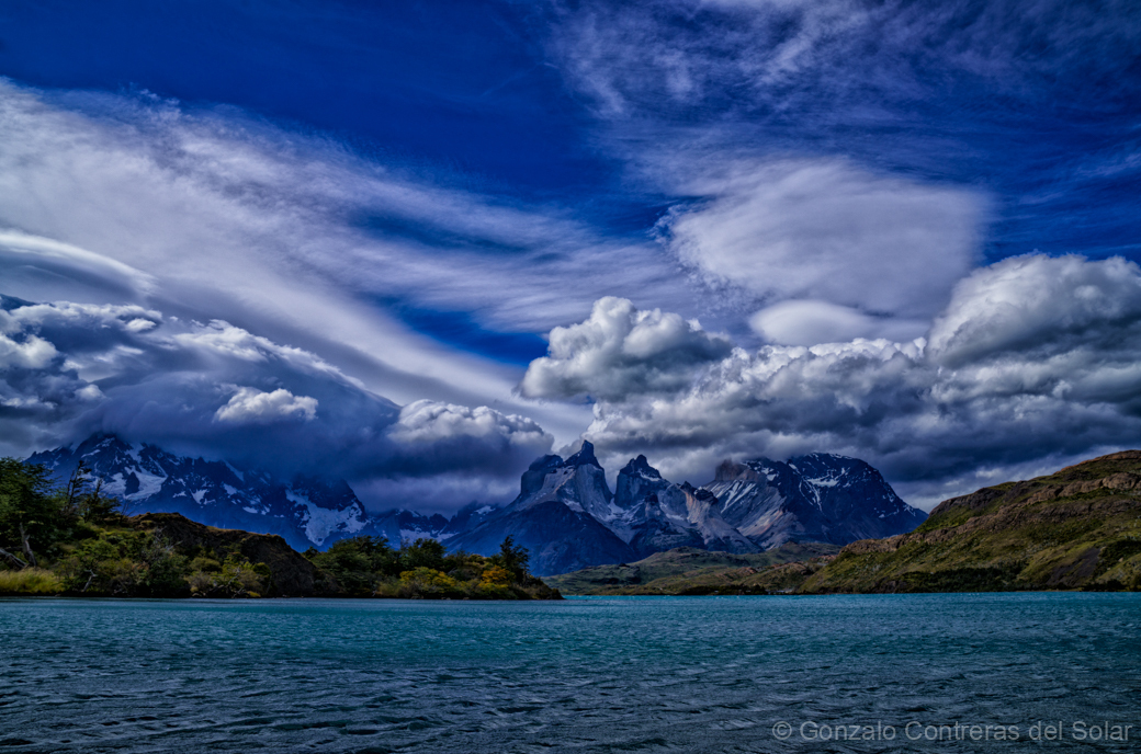
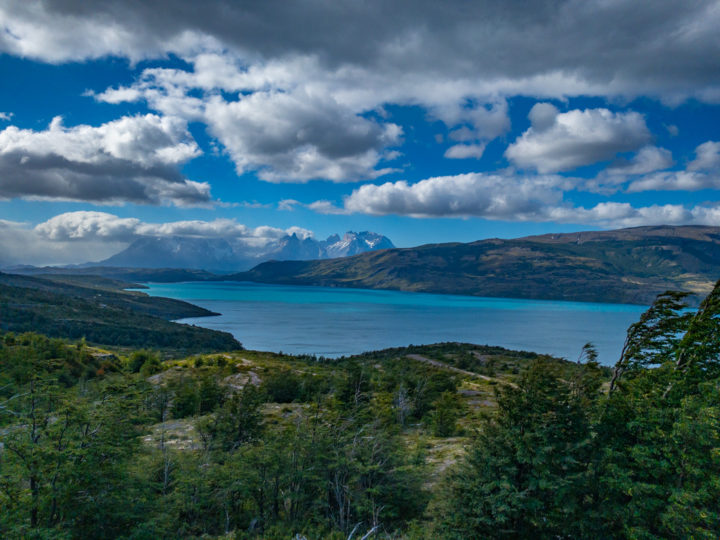
Mirador Cuernos del Paine
A few kilometers South of the park you arrive to “Mirador Cuernos del Paine” where you see the iconic horns. These mountain shapes appear in most of the images taken at the park. Lake Lago del Toro can be seen below giving the perfect view. We were informed that a week earlier this same viewpoint was covered with snow. Driving ten minutes you arrive to the park where the adventure evolves.
Acceso Serrano
The Acceso Serrano is the South entrance to Torres del Paine park. 20 years ago, I came to the same place where there was an old wooden bridge that burden down. This in-communicated the Tyndall Hotel on the other side of the Serrano river.
During my last visit, discovered a bridge and a road towards Puerto Natales were built, reducing one hour driving time. However, the shorter distance and time saving is lost due to road bad conditions, which need a speed reduction.
I always understood that the Burned Bridge (Puente Quemado), was the original shortest connection with the town of Puerto Natales. My understanding was that the burning of the bridge could have been due to a small town close to the border with Argentina, that lives from tourists’ influx, but having a longer road, people would prefer the shortest route.
It was the rivalry with the hotel located at the South side of Río Serrano. The hotel had an excellent restaurant, that captured many customers from other lodges in the park.

Although I saw the burned bridge during my first visit, I did not register it on film. Today with the construction of the new bridge, all remaining’s are gone. However, this smaller pedestrian bridge about a kilometer downstream, has the same looks of what I saw the first time.
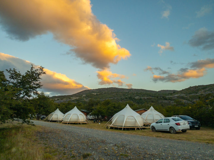
Camping Serrano
Just crossing the bridge to your left and before entering the park we found the camp site one kilometer away. Our accommodations were LotusBell Deluxe tents, having double shielding to retain the temperature, as it gets very cold at night. However only the first night we had to turn on the heater, the rest of the week was very warm.
This warm weather is hurting the glaciers that are rapidly shrinking and vanishing. Only few glaciers in the world are growing like Pio XI, one of the largest in Chile.
The scenery of the Torres del Paine horns is impressive, the same I saw when we stayed at the Lago Tyndall Hotel that was located on the other side of the river. There was no cellular signal in the park at that time, we needed to signal with the car horn, so they would collect us on a small boat.
Only recently there is 3G signal from one of the carriers (Entel), that covers only half of the park area. The mountain and glaciers trekking areas are not covered, so you would need a satellite phone for emergency purposes.

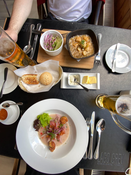
Restarant
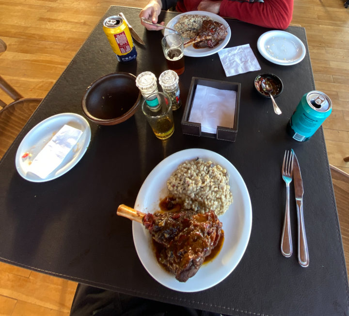
The concession managing the camping and restaurant is Chile Nativo Patagonia Travel that provides trekking and other extreme adventure services. The restaurant is new, we had one evening a fantastic lamb shank. Breakfast with fresh orange juice and eggs from a small Poerto Natales nearby farm that feed chicken with natural elements.
Due to the latitude location, Sunset is at 10PM with light till 11PM, Sunrise at 5AM with dawn from 4AM. The white lining of the tents let the late and early light pass illuminating and waking us very early.
One point, there is electricity from 8AM till 11.59PM, as the water is pumped, bathrooms only operate during this time.
Serrano river
We tried to visit the Serrano waterfalls that are South outside of the park. I asked if we could rent a zodiac, but all the service providers had closed due to Covid. The kayak provider indicated that the river current was too strong to be able rowing up stream. However, he mentioned about a trail going to the waterfalls and that a bridge was built crossing a small river.

I checked google maps, the trekking was about 6 linear kilometers, and almost flat. We drove through open terrain with Patagonia grass until we found deep car tracks that would need a 4×4 jeep. This reduced almost 1,5 kilometers walk.
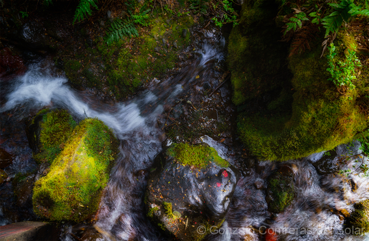
Grey and Serrano river mesh
GPS told us that we were not far from where the Grey river (tainted in gray) would merge with the Serrano river that was crystal clear and had a deep blue color. From the shore you could see the mixture, but it wasn’t as dramatic as I expected.
Guess you needed a drone, but not sure if they were allowed or the strong winds made them inoperable. In fact, in all my visits to the park I only saw once a large Army helicopter passing by.
Missing bridge
Walked towards where the satellite image showed a white blurred line that could be the bridge I was told. We found that there were only remains of what was once a pedestrian bridge. After a long arguing with my son, started walking up stream of the small creek, expect finding the recent bridge. As we walked the discussion grew, stopping where the water looked like a mirror showing below, different colors of algae. Sandwiches we had prepared helped to ease the tension.

Continued walking up stream, discovering that my son had left his walking sticks at the place we ate. It took a while to go back and forth. Looking at the surrounding it felt that there was no bridge, gave a last chance to a patch of trees. Getting close I saw a small bridge and a trail staring from it. As we walked through this forest, we found the large bridge, however it had a no trespassing sign.
Besides the sign, I saw that two trails started from the other side of the bridge. Looking at the satellite images, could not define which route to take, so we decided returning to ask further information. All trail Apps had no trails to these waterfalls, don’t know why as they look impressive from the satellite view. I was only able to see them when we took the flight back that passed over them.
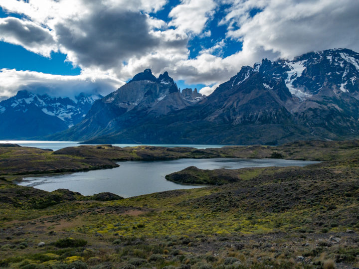
Mirador Río Serrano
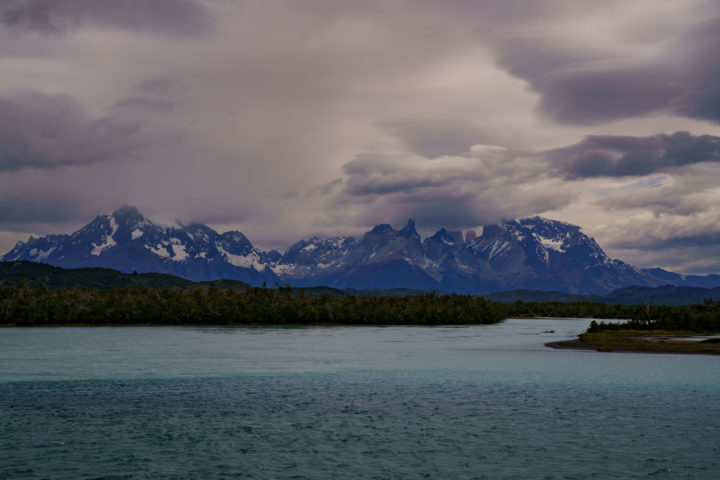
Returning from our failed trip to the Serrano falls, I saw the viewpoint signs. Stopped to check what would I encounter on a sunset. This location is amazing as you can see from this point Torres del Paine iconic horns, the upper section of the Grey Glacier and the serpentine of the Serrano River.

If you are lucky to have clouds, -as I did the following day-, have no words to express the feeling.
Lago Grey
19 years ago, we visited the Grey Lake and glacier. We took at that time a very small boat named Grey I. During the trip the wind was so strong that it collided with the front windshield, forming curious designs that I was able to register on film.

While taking pictures of the colliding water, I noticed that a group of people were filling release forms. I asked if we all had to fill and sign them. They were only for the group that would go out walking on the glacier. A few minutes later I had signed the release form. My guide helped me descend throughout a Moulin, a large hole formed in the glacier. This is due to a small rock that absorb the sun light, slowly melting the ice.
")
It would take many years to create a hole large enough for me to descend with camera and tripod.
Glaciar Grey
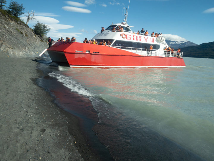
In 2013 I returned with my daughter to hike again on the glacier. We took the Grey II boat that left us on a camp close to the glacier. Learning on our arrival that the glacier hiking was canceled due to malfunctions of the Zodiac that took you to the side of the glacier where the adventure started.
New trip
During this trip with my son, we both had the goal to walk over the ice. Due to Covid, the number of trips per day that the Grey III boat were limited. We could not take the early boat towards the glacier and return on the 4th trip that was late enough to allow us to trek over the ice for a couple of hours.
Nevertheless, we were able to take a kayak tour that went towards where the floating icebergs were located.
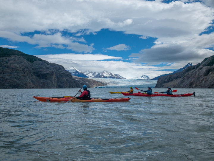
Big Foot provided kayak services as well as the glacier walks that I had taken years ago. The team was professional, and they had good equipment to protect us. I was able to carry my camera and take pictures from the kayak without risking dropping my precious equipment. There was little wind, so we could get closer to the glacier, in fact we had good weather all week.

The camera went on a dry bag, carefully opening, taking pictures, and putting it away, assuring not to drop it. The lake is deep, and even if you would be close to the shore, the water is tainted gray due to the lime that glacier pulverize as it descends, you cannot see anything beyond a meter. This gray color gives the name to the lake and glacier “Grey”. Due to this thin rock floating powder, there is no light passing by, so no fish or live mater on this lake.
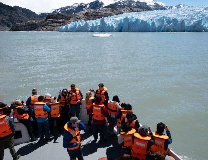
During my first visit in 2002, the glacier was divided into 2 tongues. Sadly, this year there are now 3 tongues, each smaller compared to what I saw early this century. The entire section where I walked vanished, based on image GPS data of then and now, two kilometers melted away.
Mirador Glaciar Grey
Last time I came to this viewpoint called “Mirador Glaciar Grey” I could hardly walk as I had kidney stones. From this place, you could walk down to a cove where most of the glacier icebergs would reunite. I was able to make a few images on film but was not very happy with the outcome. This time I was prepared with a large sensor digital camera, and no health issues.

Unfortunately, when we arrived there were many signs blocking the trails going down to the cove. While we were looking at the melted glacier, a pair of “Condor” flew over us, displaying their huge wings. On some occasions they would almost literally stop in the air to observe like a drone.

Next time I will look for permits to walk down to the cove and register the icebergs.
Refugio Grey
Refugio Grey is located close to Grey Glacier, North of the park. It is well placed to receive all the hikers trekking the “W” as it is called. You can arrive walking around the Torres del Paine horns, or taking the boat that crosses the Grey Lake.
It’s prepared to receive hikers only wanting to rent a tent, including a sleeping bag, so you can travel light. Or you can also rent a room and bed with central heating.
They do have a restaurant, but you need to book a seat in advance. This zone of the park has no cellular access, so you need to use internet of the lodge.
There is also a store with supplies and good Patagonian beer that takes very good after a long trekking.
The last fire that destroyed thousands of square miles was caused by a tourist that burned a toilet paper. Since then, strict rules were enforced, during our tour two tourist were expelled and deported because they lit a fire. By the way, smoking is prohibited in all the park, however this lodge has a smoking area.
Salto Grande
The Salto Grande waterfall is located between lakes Nordenskjöld and Pehoe, in fact it communicates both Emerald colored lakes.

Lake Nordenskjöld has strong winds. The waterfall receives this wind blowing mist all around, making it difficult to take pictures without ruining your camera. It is an interesting visit, 600 meters from the parking, but not my first option to visit.
Lago Nordenskjöld
Don’t know why, but this is one of the windiest areas of the park, at least that I know. We wanted to visit the Mirador Cuernos, which is just in front of the horns across the lake. It takes about 30-40 minutes from the parking zone; you pass a side of the Salto Grande waterfall.
When we arrived, I tried to take some pictures of whirlpools forming over the lake. However, they were small and not as large as the one I saw on arrival, while my camera was still packed. We stayed for some time, but nothing impressive occurred.
Although I was using a tripod, I could feel the vibration of the strong wind that was about 80 Km/hour. This vibration made impossible to take a sharp picture; will have to return another time. Wanted to see the whirlpools which are formed horizontally, that I once saw from another parking zone of the lake. On that occasion I saw a bus that the entire front windshield popped out when the lateral door was opened.
Cascada Río Paine
Compared to Salto Grande waterfall that you needed to walk 600 meters and a strong wing, on the Cascada Río Paine waterfall, you drive just in front of it. The rock formation and design are totally different to other waterfalls in the park.
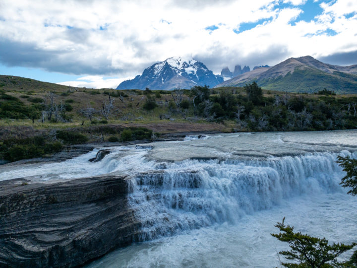
I made film B&W images during my first visit 2 decades ago. This time I made new images, but they were no match to the original image taken on film.

Noticed to mention that some tourist groups took 5 minutes from arrival, walking around and getting back into their vans.
Where to dine
Many restaurants in the park have closed. We were only able to dine at our camp and at the Grey Hotel which has a very good chef.
Possibly at the luxurious Explora hotel, but were not sure if they would accept outsiders to use the hotel restaurant.
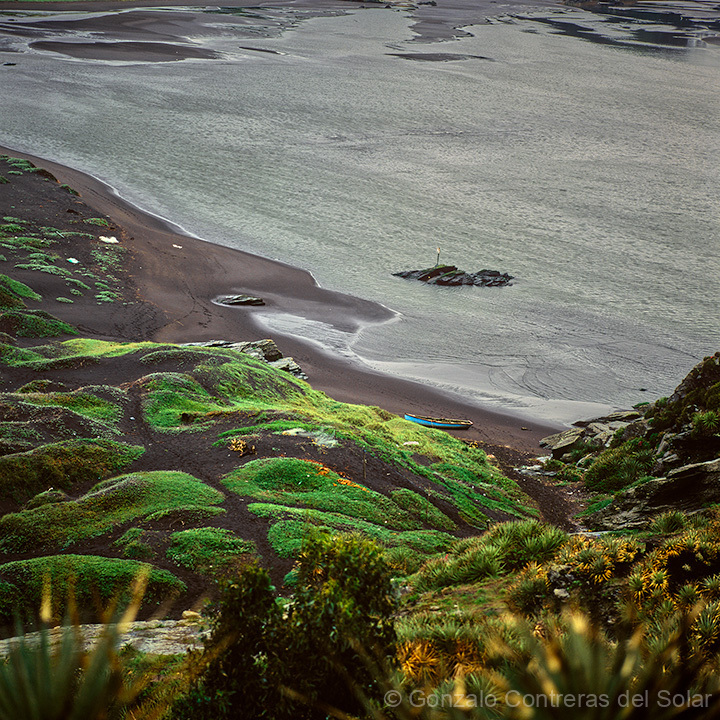
Restaurant Pehoe Barbecue
This is another casualty of Covid, we were well recommended to dine on this place. However, when we arrived, we learned that the owner would not open the restaurant for this summer season. Same comment we heard in a few other places. The number of people needed to operate is big, and the uncertainty of lockdowns based on number of cases, change every week, makes it unviable.
The view of the horns from this location is incredible as you can see in the image.

The only option is a small store where you can buy few groceries.
Hosteria Pehoe
This old lodge located on a small island on lake Pehoe, connects to mainland via a small pedestrian bridge. The initial section of the bridge was a little shaky, I can’t imagine walking over it on a windy day.

Walked towards the lodge to have lunch, but discovered it was closed as they had an event later that evening. This lodge is iconic for many park images, especially the connecting bridge, the view is majestic.
Explora & Salto Chico
The Explora Hotel is considered one of the most luxurious hotels in the park. It is built with a vantage view of the Torres del Paine horns, as well as the Salto Chico waterfall. Wanted to see the waterfall, so we had to park outside of the hotel area and walk towards the waterfall. Had wooden trails, but most of the wood was rotten, you could see broken ones that someone had stepped on.

The waterfall is not big and has the annoying view of the powerhouse that uses the energy of the waterflow.
Camp Patagonia
The story I am focusing now is older than the burned bridge I mentioned earlier. Started when investors negotiated with the government investing on a tourist center if the government constructed a road. For 40 years they had a legal battle until the government agreed to construct the road. The road would have a shorter route to the park ending where the burned bridge was located. It not only served the park but all the river south side infrastructure which could only be reached by boat.
The tourist center that was constructed is called Camp Patagonia, which is located at Lago el Toro. This lake that is about 10 kilometers South from the Torres del Paine Park.
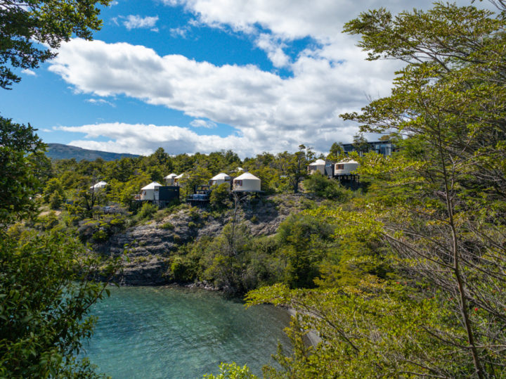
The architect defined that the rooms to be a Mongolian Yurt of 20 square meters each. They are all luxury bedrooms, some with Jacuzzis and scattered in the forest, avoiding cutting trees.
All pathways are wooden bridges about half a meter over the terrain to avoid destroying the environment.
The main reunion center and restaurant have trees in between, showing that the architectural design had to respect nature.
The lake has no housing or any other constructions, except another resort to the Southeast. I could not see any boats, only Kayaks from Camp Patagonia.
My next trip to the park will try to stay on this beautiful lodge.
Asador Patagónico
At the park we confirmed the restaurant was still operative, mentioning on Sundays most places at Puerto Natales were closed.
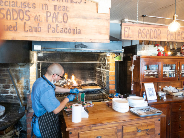
Sitting on a tall chair and table, I noticed empty the round cooking place where the entire lamb is cooked on a cross shaped sword, placed adjacent to a fire.
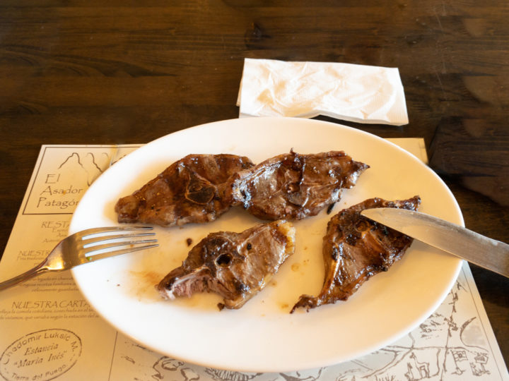
After asking what happen, they told us that it was only served during the evenings (this was due to Covid). We had to settle with grilled lamb chops, which were very good, same taste as before, a place to visit.
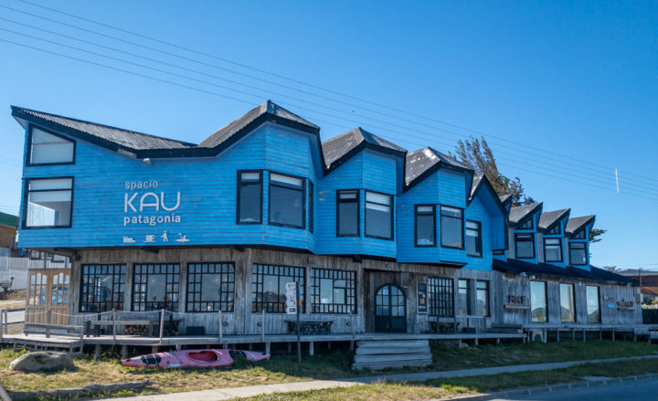
Kau Hostel
The Kau Hostel is small and adjacent to Puerto Natales estuary, all rooms have view to it. The lodge is prepared for winter and cold days being the standard, however the entire week we had warm weather. Although the window was open there was no wind, fortunately the hotel delivered a large fan that helped cooling it.
Breakfast is considerable that allows you to stay without needing to eat for a long time.
The airport is about 10 minutes away and taxies arrive immediately after calling, costing about 10 dollars. Not sure if Uber was available.
Coffee Maker
The Coffee Maker is the small restaurant belonging to the Kau Lodge, where we were staying. They have a just set of dishes, and serve the breakfast that is included with the lodging.
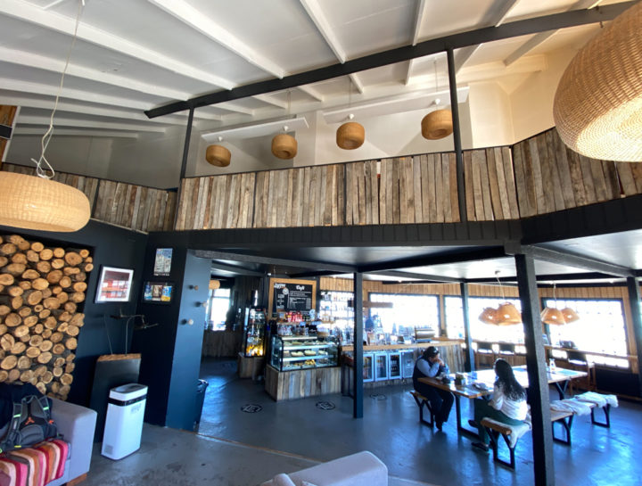
The coffee is very good as well as the pastry. The hotel is in front of the Estuary, so from your table you have a beautiful view of the sunset; however during December sunset is at 10PM and dusk until about 11PM, by that time the restaurant is closed, if you were planning to have drink.
Ultima Esperanza
Covid had an impact on a few restaurants at Puerto Natales. We were looking for a beer factory, but we found it apparently permanently closed. Restaurants that were opened were not what we looked for. We already had lunch at the Asador Patagónico, when we found a restaurant that had a very formal construction. The interior had the format of the old traditional restaurant. Named Última Esperanza (Last Hope), taking the name of the Seno de la Última Esperanza, close to Puerto Natales.

We both had beaf prepared in different formats: “Milanesa” Milanese and “Lomo a lo Pobre” beaf with onions, potatoes and topped with 2 eggs.
Both dishes were excellent. We noticed that there were no tourists, they were all local families.
During the entire week of my fourth tour to Grey Lake, we had very good weather, being told that we were lucky. Had different cloud formations, including lenticular clouds (story of another post), two trips over the lake with excellent light. Although flights and boat rides were fully booked, there was a great reduction of travelers.
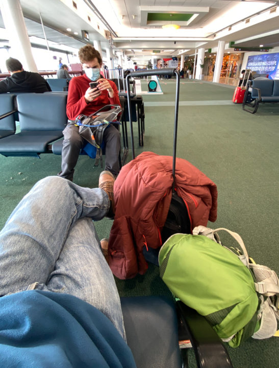
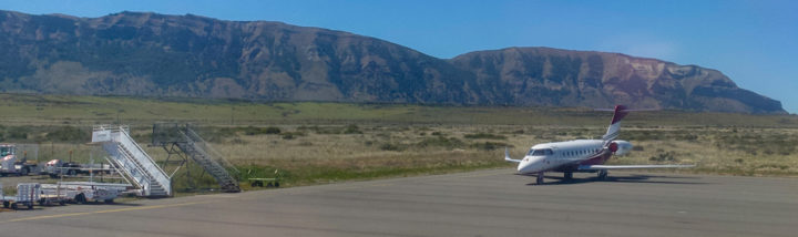
Awaiting our flight to leave noticed that there was a private jet parked, a good way to have full mobility.
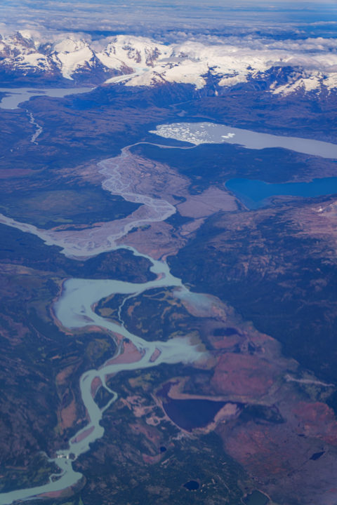
Serrano Waterfalls
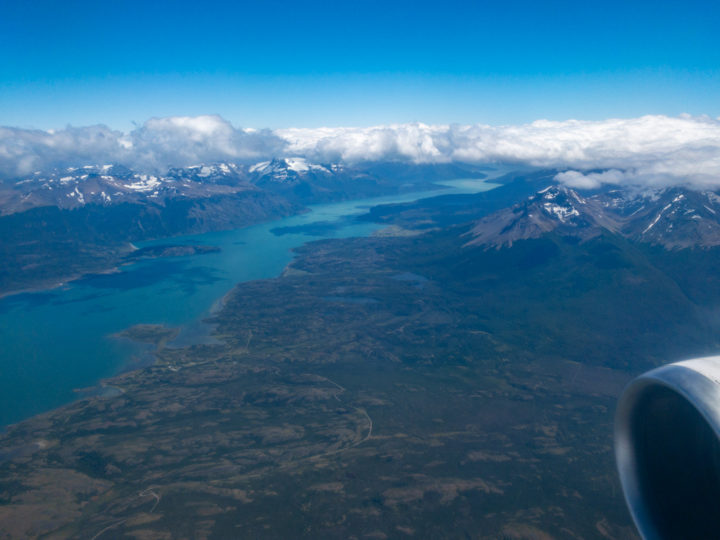
Few minutes later we would be flying over the park. I could see the Serrano river and the waterfalls I wanted to photograph. I managed to take an image, but the airplane window distorted and ended with a blurry image. The waterfalls are at the lower left of the image.
You can see additional images of the Grey Lake fourth tour at this link.